The drone you hire matters.
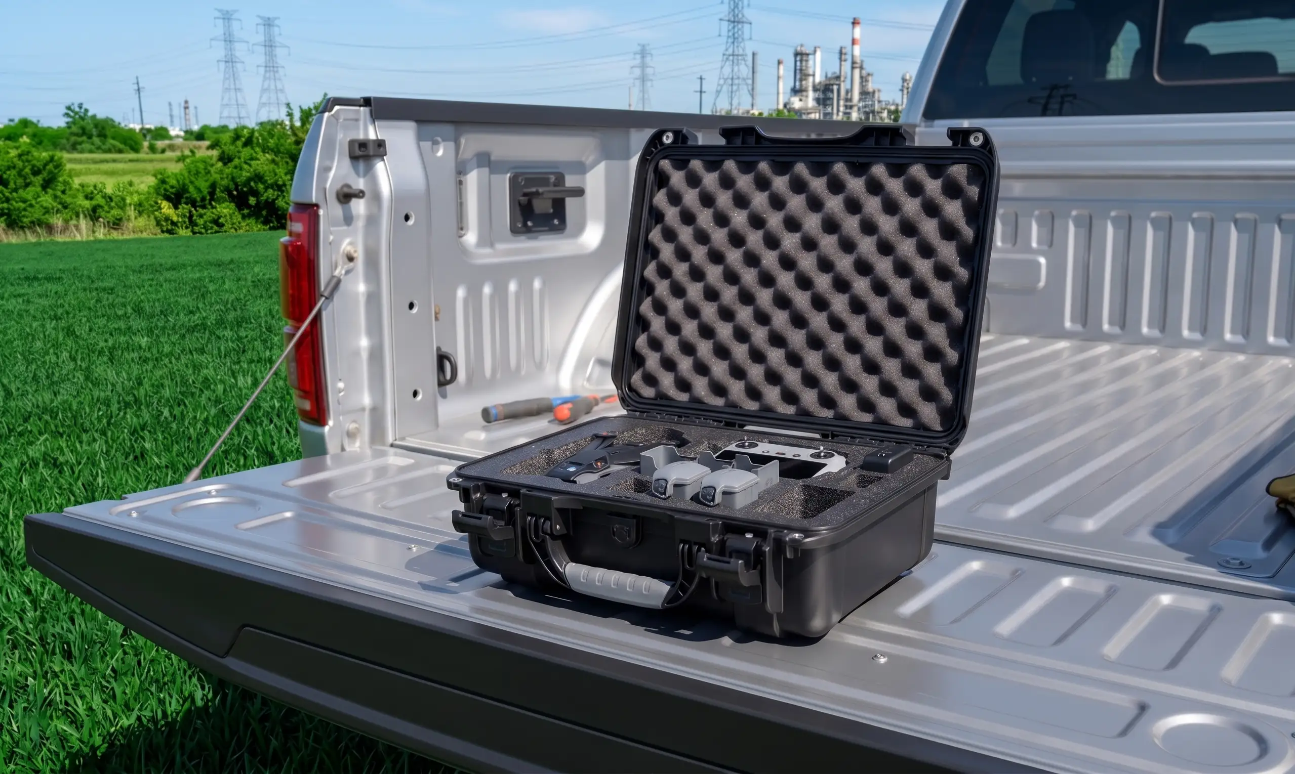
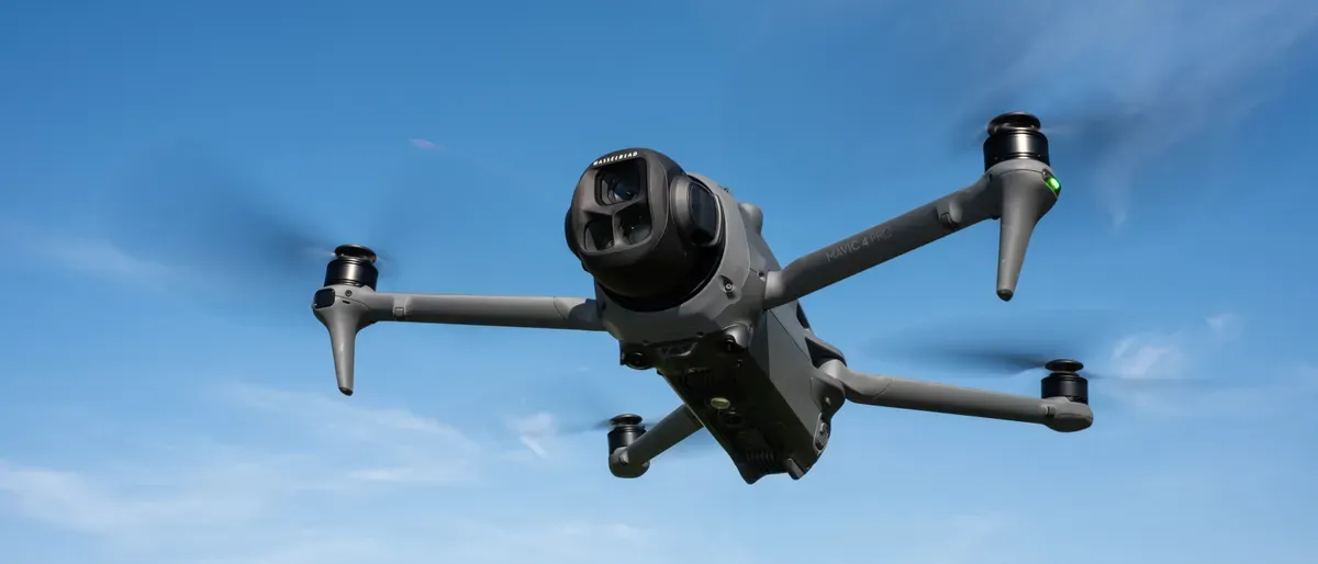
The platform a pilot flies determines what they can see, how close they can safely operate, and how much detail ends up in your report. Vantage Drone Co. flies a current-generation DJI Mavic 4 Pro, a professional imaging platform with a triple-camera array, upward-tilting gimbal, LiDAR obstacle avoidance, and 51-minute flight time.
DJI Mavic 4 Pro
Fly More Combo
Every inspection we deliver is built around this platform's capabilities — a professional-grade aircraft with a triple-camera payload, designed for operators documenting structures at safe standoff distance.
- Hasselblad main
- 100MP
- Upward tilt
- 70°
- Flight time
- 51 min
- Low-light floor
- 0.1 lux
Inspection-grade drone capabilities and sensors
Triple-camera system
A Hasselblad 100MP main camera for context and elevation, a 48MP medium telephoto for mid-range documentation, and a 50MP long telephoto that reads shingle granules, mortar joints, and fastener detail from safe standoff. Wide, mid, and close-detail shots of the same structure from a single flight — without ever flying near the building.
360° Infinity Gimbal with 70° upward tilt
Most drones only look forward or down. The Mavic 4 Pro's gimbal rotates a full 360 degrees and tilts up to 70 degrees above horizontal — we can document the underside of a bridge deck, the edge of a balcony, or the inside of a soffit that a ground-level or scaffold inspection misses entirely.
LiDAR + 360° obstacle sensing
A front-facing LiDAR sensor paired with six low-light fisheye cameras gives full omnidirectional awareness. Safe operation around steeples, towers, bridge cables, and facade ornamentation. LiDAR keeps working in fog, glare, and low light where optical-only systems fail.
6K HDR imaging with dual-ISO fusion
The main Hasselblad sensor captures 6K HDR video and 100MP stills with dual-ISO fusion — bright sky and shadowed roof areas both hold detail in the same image. The difference between a usable inspection image and an unusable one when HVAC units are casting hard shadows.
0.1-lux low-light operation
For early-morning roof flyovers before a facility opens, storm documentation in marginal light, or tower inspections scheduled around work crews — low-light sensors and LiDAR-assisted navigation support legal, safe flight under appropriate FAA Part 107 authorization.
O4+ video transmission, 18.6-mile range
A rock-solid, uninterrupted video link at any realistic inspection distance. FAA rules keep the drone within visual line of sight — the practical benefit is a signal that holds in dense urban environments with radio interference.
The numbers, at a glance.
- 01 Platform
- DJI Mavic 4 Pro (Fly More Combo)
- 02 Main camera
- 100MP Hasselblad · 6K60 HDR · variable aperture
- 03 Medium telephoto
- 48MP · 4K60 HDR
- 04 Long telephoto
- 50MP · 4K60 HDR
- 05 Gimbal
- 3-axis 360° Infinity Gimbal · 70° upward tilt
- 06 Obstacle sensing
- Front-facing LiDAR + 360° omnidirectional cameras
- 07 Low-light capability
- 0.1 lux
- 08 Flight time
- Up to 51 minutes per battery
- 09 Transmission
- DJI O4+ · up to 18.6 miles
- 10 Controller
- DJI RC 2 with built-in 5.5" 1080p display
- 11 Batteries carried
- 3
Every flight is planned and authorized before the drone leaves the case.
- 01
Aloft Air Control (LAANC)
Same-minute FAA Low Altitude Authorization and Notification Capability clearance around Logan, Hanscom, Norwood, Worcester Regional, Barnstable, Providence T.F. Green, and every other towered airport in our service area.
- 02
B4UFLY & SkyVector
Pre-flight airspace briefings cross-reference the FAA's B4UFLY and SkyVector for comprehensive coverage of temporary flight restrictions, NOTAMs, and military operations areas.
US-hosted. Segregated. Retained for three years.
Every image and report captured for a Vantage Drone Co. client is stored on US-based cloud infrastructure and retained for a minimum of three years. Client folders are segregated; imagery is never commingled.
Two-factor authentication is enforced on every storage account. Raw imagery is available to clients on request for the project's lifetime.
Every flight is operated under a valid FAA Part 107 Remote Pilot Certificate with $1 million in aviation liability coverage. Additional-insured certificates are available on request. The Mavic 4 Pro itself is registered with the FAA and listed on our aviation policy as a scheduled aircraft.
Planned future additions.
Our equipment roadmap adds a dedicated thermal inspection platform supporting solar array inspection, moisture detection on commercial roofs, and heat-loss surveys. A dedicated mapping and photogrammetry platform with mechanical shutter and RTK support is planned as capacity grows. Additions will be published on this page when operational.
Ready to put this platform on your site?
Tell us what you need documented. Every quote comes back with a fixed price, a turnaround commitment, and a proposed flight date.