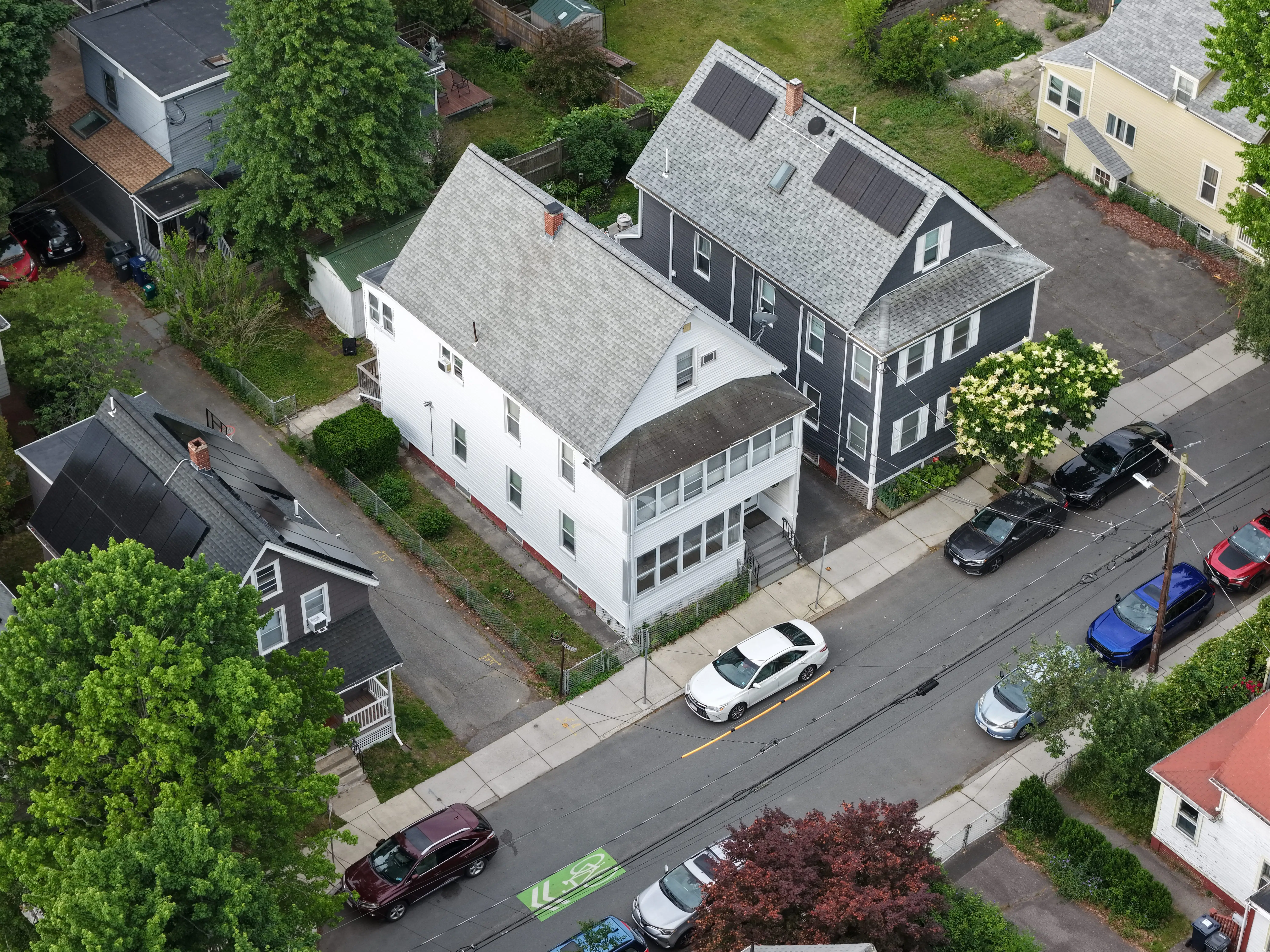
Drone Real Estate Photography
Aerial listing photography that gets a home, its lot, and its surroundings into a single frame. Vantage Drone Co. shoots drone real estate photography across eastern Massachusetts for listing agents, homeowners, builders, and developers — edited, MLS-ready stills delivered within one week.
What a drone real estate photography shoot covers
Edited aerial stills — web and MLS ready
High, mid, and low-altitude photographs of the home, frontage, lot lines, and surrounding context. Color-corrected, exported at MLS-compliant resolution, and delivered as a shareable gallery within one week.
Multiple angle coverage
Front elevation, rear elevation, profile shots, top-down site context, and feature shots of decks, pools, outbuildings, waterfront, and acreage. Every angle a buyer wants to see before booking a showing.
Optional golden-hour or twilight session
A second sortie at golden hour or twilight, scheduled around weather and time of year. Twilight imagery consistently drives the highest engagement on luxury and waterfront listings.
Real estate photography vs. a drone home inspection
Real estate photography
Built for marketing. Composition, light, and angle are the priority. The deliverable is a gallery of beautiful, color-corrected images that sell the property — not a condition report. Best for listings, brochures, websites, and developer marketing.
Drone home inspection
Built for documentation. Detail, coverage, and a PDF report are the priority — see the home inspection page for that workflow. Best for due diligence, insurance, and pre-purchase decisions.
Where drone shots earn their keep.
Pre-listing marketing
Aerial photography is the differentiator on listings over $750K and on any home with acreage, frontage, or a memorable lot.
Waterfront and pond-front homes
Show the relationship between the home, the water, and the lot — something a ground-level photographer simply cannot capture.
Estates and large acreage
Communicate lot scale, tree lines, outbuildings, and parcel context in a single image rather than asking buyers to imagine it from a plat map.
New construction and developments
Marketing imagery for builders, developers, and listing agents on spec homes and subdivision rollouts.
Pre-renovation portfolio shots
Architects, designers, and contractors document a property before the work begins for portfolios and case studies.
- Listing agents and buyer's agents
- Homeowners listing for-sale-by-owner
- Builders and developers
- Architects and residential designers
- Landscape and outdoor-living contractors
- Estate administrators preparing a property for sale
Before you book.
- 01
What does a drone real estate photography shoot include?
A combination of high, mid, and ground-level aerial stills covering the home, lot lines, frontage, surrounding context, and key exterior features — delivered as edited, web-ready files within one week.
- 02
How many photos do I get?
Typical residential listings receive 12–20 edited stills. Larger estates, multi-structure properties, and waterfront homes receive 20–35. Final count is set by what the property actually needs, not a fixed package.
- 03
Can you shoot at golden hour or twilight?
Yes. Golden-hour and twilight shoots are scheduled around weather and time of year. They add visual warmth that drives listing engagement, especially on luxury and waterfront properties.
What Vantage Drone Co. does — and doesn't do.
Vantage Drone Co. is a drone imaging and documentation service. We capture comprehensive, professional-grade aerial imagery and deliver it as a clearly organized PDF report.
We are not licensed roofers, structural engineers, home inspectors, or insurance adjusters. We do not make repair recommendations, structural determinations, or claim valuations. Our deliverable is the imagery and documentation — interpretation is handed off to your listing agent, builder, or marketing team.
Book a real estate photography shoot.
Address, listing date, and whether you want a golden-hour or twilight session — that's all we need to quote and schedule.