Drone Storm Damage Documentation
Claim-ready imagery in 48 hours. Vantage Drone Co. provides rapid post-event drone imagery after wind, hail, ice, and coastal storms across eastern Massachusetts. Our reports are built to drop directly into an insurance claim file or restoration scope of work — labeled, timestamped, geotagged, and organized to claim-grade documentation standards.
What's in every storm damage drone report
Wide-context elevation imagery
Establishes the scope, orientation, and surroundings of the affected property for the adjuster or contractor reviewing the file.
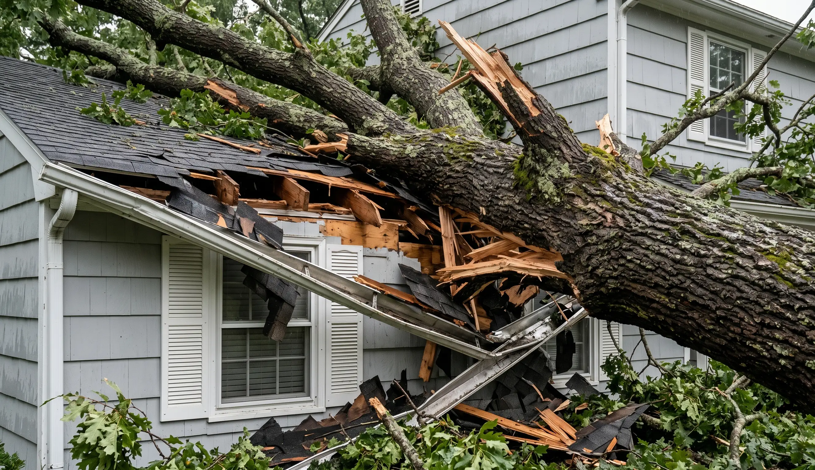
Close-visual imagery of every area of interest
Individual areas — missing shingles, surface impact marks, lifted material, tree-strike sites, displaced gutters — captured at detail resolution. Your adjuster or roofer makes the call on cause and scope.
Pre-event baseline when available
When a prior Vantage Drone Co. inspection exists, before-and-after imagery is included.
Annotated PDF formatted for claims
Labeled, timestamped, geotagged imagery in a report designed to be submitted into a claim file without reformatting — for your adjuster's assessment.
72 hours, with a retainer option.
72 hours
Within 72 hours of a major regional storm. Faster for pre-booked priority clients.
Guaranteed
Adjusters and restoration contractors can pre-book a guaranteed response window under a monthly retainer.
Scene documentation is a trained skill.
Storm damage documentation is, at its core, scene documentation — a discipline with a specific format that adjusters, public adjusters, engineers, and attorneys rely on. Our reports organize imagery the way an incident report is organized: clear, defensible, and useful inside a claim file. The cause-and-scope determination stays with your adjuster.
Nothing in the imagery is left ambiguous.
When a drone belongs on the claim file.
Storm response is the most common trigger, but the same scene-documentation discipline applies before a loss, after a reinspection request, and across a regional CAT deployment.
Property loss documentation
Post-event imagery for wind, hail, hurricane, nor'easter, and ice damage claims.
Pre-claim baseline imagery
Homeowners and commercial property owners establishing condition before filing a claim.
Reinspection & second-opinion work
Independent aerial documentation supporting public adjuster or attorney engagements.
Subrogation investigations
Documentation of adjacent properties, tree sources, or contractor-caused losses.
Underwriting & renewal
Pre-policy and renewal imagery for underwriting teams reviewing property risk.
CAT deployment support
Deployed imagery for adjusters working a regional event at scale.
- Independent & public insurance adjusters
- Property insurance carriers and underwriters
- Restoration contractors
- Roofing contractors handling claim work
- Homeowners filing claims
- Property managers (portfolio documentation)
- Real estate attorneys on loss disputes
- Subrogation investigators
- CAT deployment teams
- Municipal emergency managers
Before you book.
- 01
How fast can you respond to storm damage?
72-hour commitment for pre-booked retainer clients; faster in many cases. Same-day surcharge available for active claim-cycle work.
- 02
What's in a storm damage drone report?
Dated, geo-tagged imagery formatted for direct inclusion in an insurance claim file, organized elevation-by-elevation and by area of damage.
- 03
Do you work directly with insurance adjusters?
Yes — public and carrier adjusters are core clients, and reports are formatted for claim-grade documentation.
What Vantage Drone Co. does — and doesn't do.
Vantage Drone Co. is a drone imaging and documentation service. We capture comprehensive, professional-grade aerial imagery and deliver it as a clearly organized PDF report.
We are not licensed roofers, structural engineers, home inspectors, or insurance adjusters. We do not make repair recommendations, structural determinations, or claim valuations. Our deliverable is the imagery and documentation — interpretation is handed off to your insurance adjuster, public adjuster, or restoration contractor.
Request storm damage documentation.
For urgent post-storm work, call or text directly. We prioritize active claim-cycle requests.